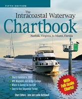
The Intracoastal Waterway Chartbook, Norfolk, Virginia, to Miami, Florida

|
 |
Descrizione |
Find your way down the Intracoastal Waterway between the Chesapeake Bay and Florida
The Intracoastal Waterway Chartbook provides a complete set of navigational charts (a $350 value) for the 1,090-mile ICW from Norfolk to Miami, as well as major Atlantic inlets, in a single, easy-to-use $70 package. Proven over 16 years and four prior editions, the Chartbook includes a complete listing of waterway bridge and lock characteristics, anchorages and waterway facilities; also pilotage notes, mileage charts, and charts for a picturesque alternate route.
|